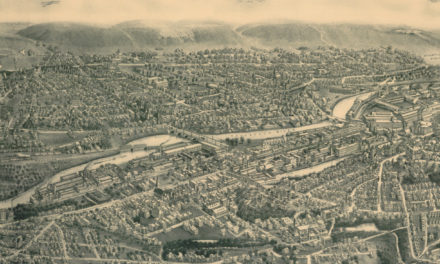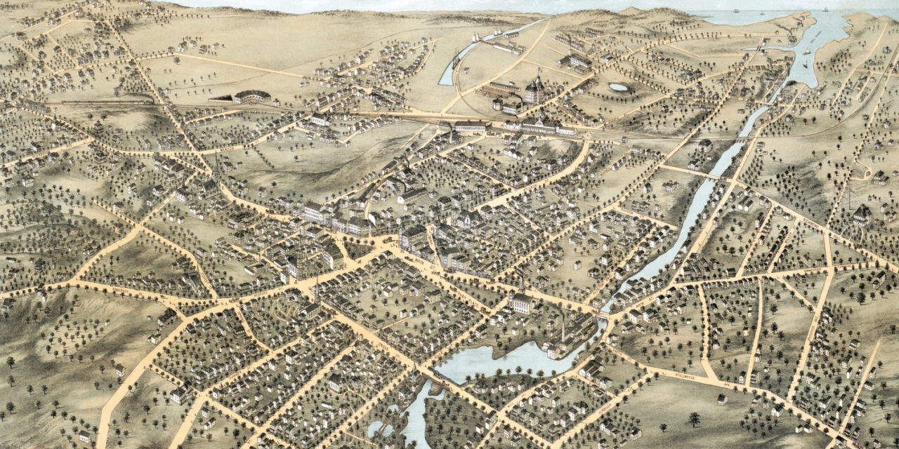
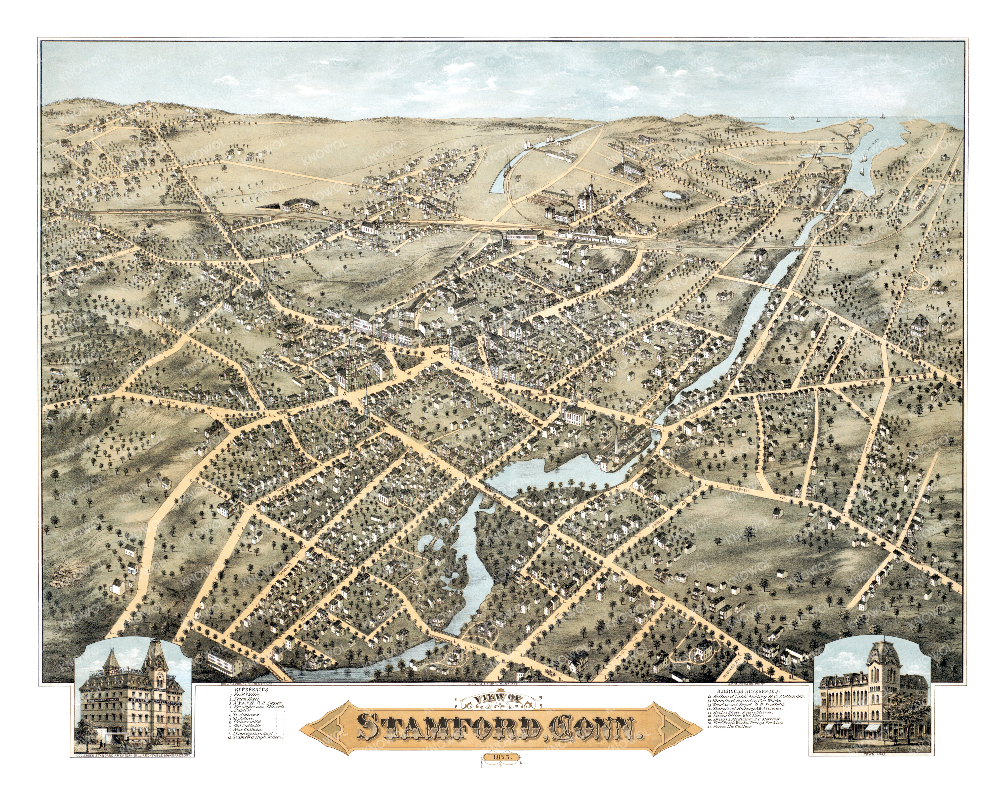
This old map of Stamford, Connecticut was created in 1875 by O.H. Bailey, a prominent 19th century cartographer. The map shows a detailed bird’s eye view of Stamford as it used to be, including street names and old landmarks.
Landmarks on the map include Collender’s Billiard Table Factory, Stamford Foundry Works, Scofield’s Wood & Coal Depot, Stamford Bakery, Jones & Stetson’s Boots & Shoes, Morrison’s Drugs & Medicines, Ferris the Clothier, and more.
This historic map of Stamford, CT has been restored by KNOWOL. Reproductions of the map are available here.
Bird’s Eye View of Stamford, CT in 1875
This map of Stamford will make an attractive addition to your office, library, or den and can even be used to teach children the geography and history of the area. When you’re done exploring, click here to get your copy.