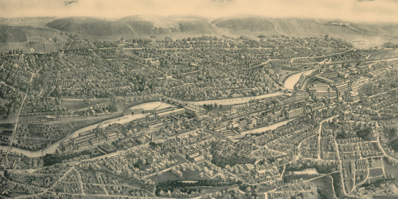
This map of Ansonia, Connecticut was originally published in 1921 by Hughes & Bailey Publishers of Waterbury, CT. The map has been lovingly restored by the team at KNOWOL. Reproductions of the map are available through our store, and a free high resolution version can be viewed below.
The map shows an aerial view of Ansonia, Connecticut in 1921 featuring town landmarks and a compass showing Ansonia’s distance to Boston, New York, Providence, New Haven, Albany, Waterbury, Hartford, the Hudson River and the Long Island Sound. Click here to see the restored map.
Historic Map of Ansonia, Connecticut in 1921
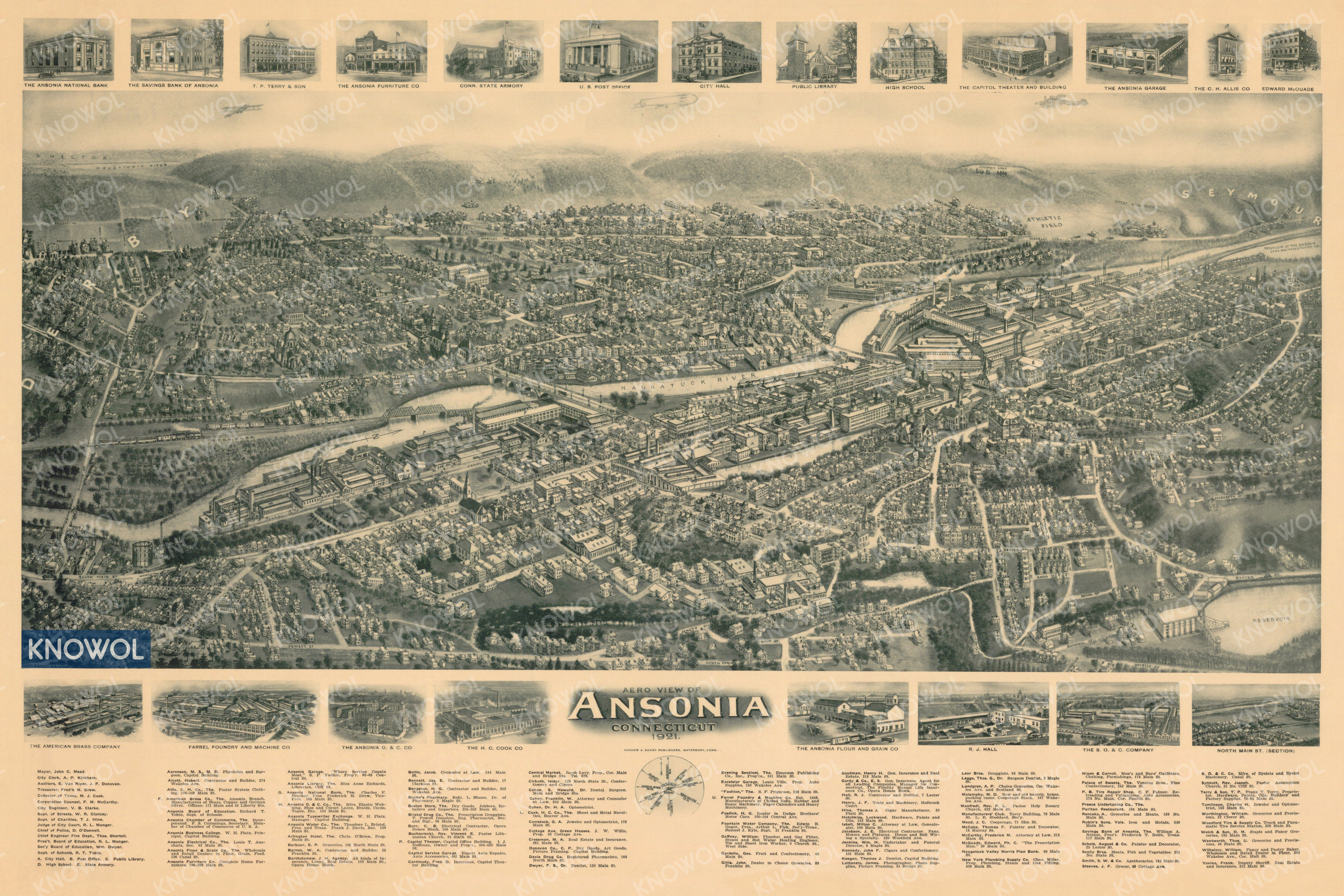
Old Ansonia landmarks on the map include The American Brass Company, Farrel Foundry and Machine Company, The Ansonia O. & C. Company, The Fountain Water Company, Fountain Lake, The Capitol Theater and more.
Reproductions of the restored map are available on museum quality, archival matte paper to ensure that this piece of Connecticut history can be passed on to the next generation. Click here to get yours, and share with friends!