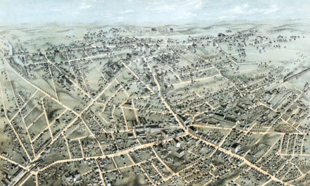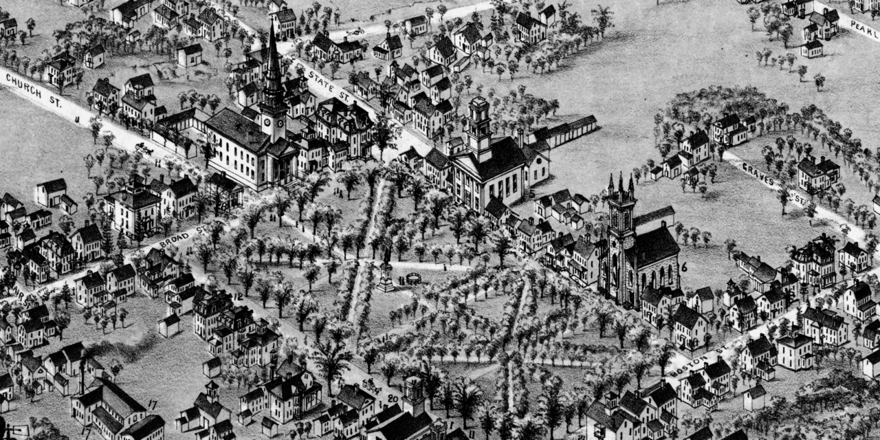
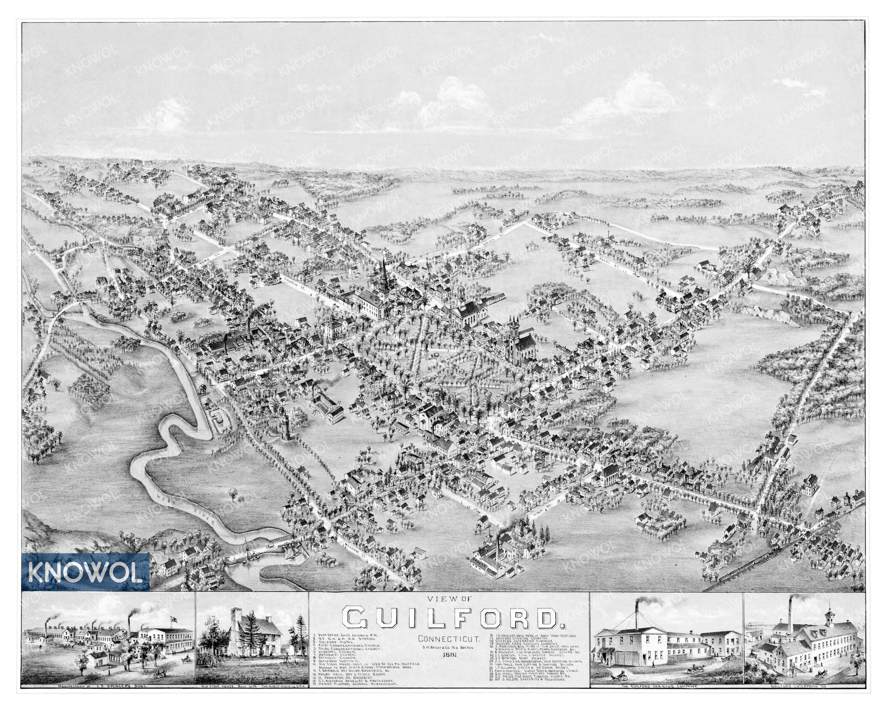
This historic map of Guilford, Connecticut was created in 1881 by O.H. Bailey, a prominent 19th century map maker. The map shows a bird’s eye view of the area as it used to be, including street names and old landmarks.
Landmarks on the map include the New York, New Haven & Hartford Railroad Station, Guilford Hotel, Old Stone House, Henry Hale’s Fancy Goods, Guilford Canning Company, Norton’s Fish & Oyster Market, Fable’s Hair Cutting & Shaving Saloon, Williams’ Oyster & Ice Cream Saloon, a variety of churches, and more.
This historic map of Guilford has been restored by KNOWOL. Reproductions of the restored map are available here.
Historic Old Map of Guilford, Connecticut from 1881
This vintage map of Guilford makes an attractive addition to your office, library, or den, and can even be used to teach children the geography and history of the area. When you’re done exploring, click here to get your copy of the restored map.