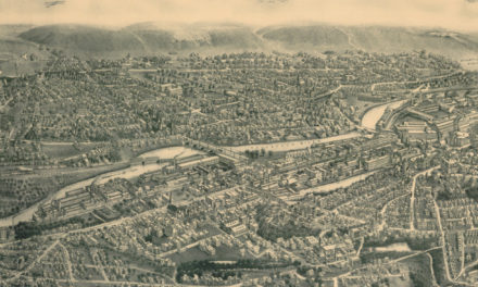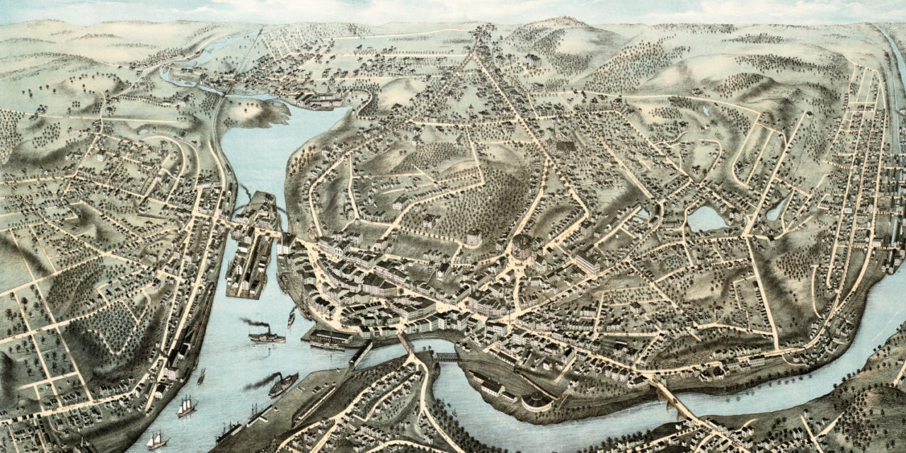
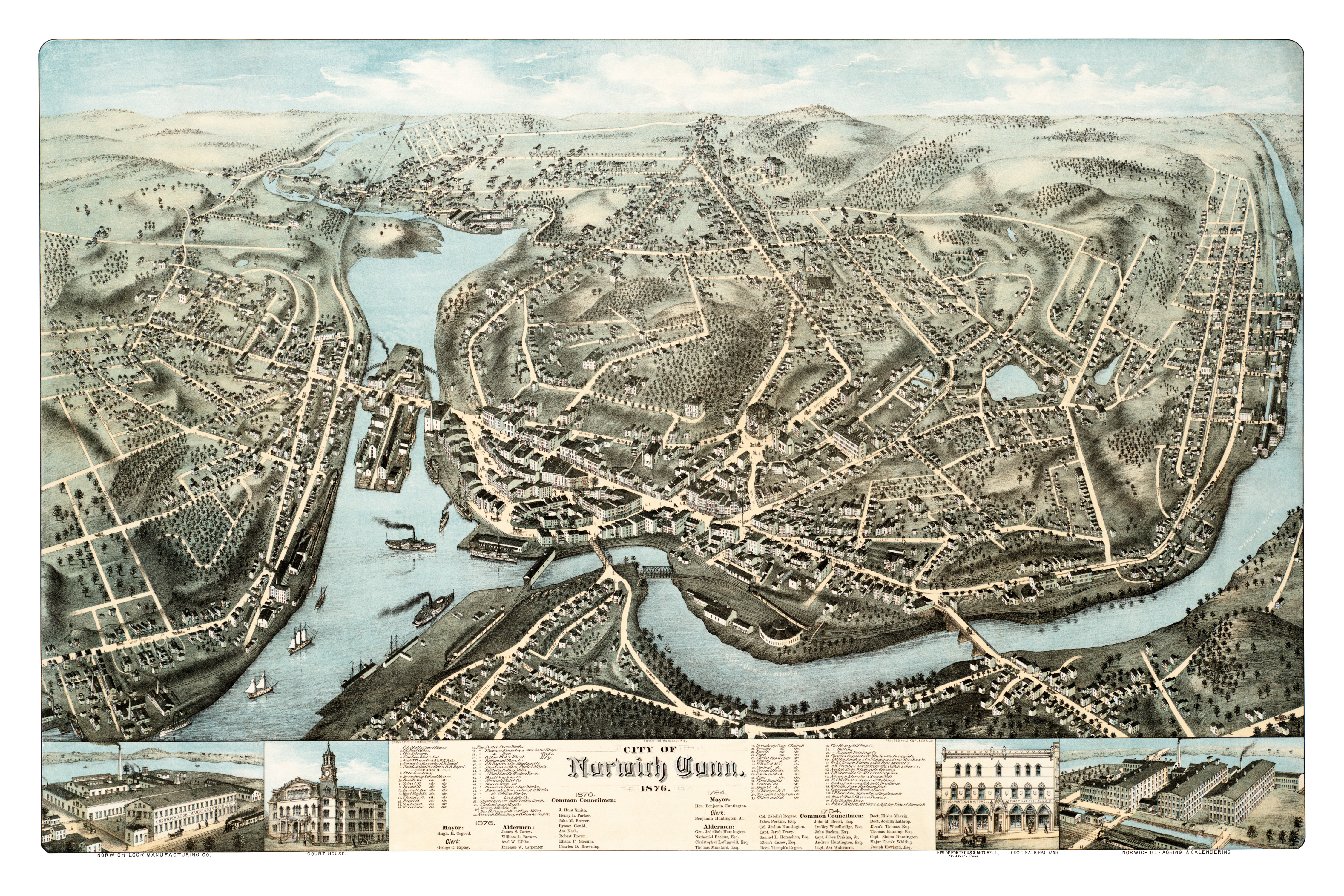
This map of Norwich, Connecticut was created in 1876 by O.H. Bailey, one of the most prolific map publishers of the 19th century. The hand drawn map shows a bird’s eye view of Norwich including street names and historic landmarks.
Old landmarks on the map include Norwich Free Academy, The Henry Bill Pub, Otis Library, Ripley’s Art Store, Norwich Printing Company, Norwich Lock Manufacturing, Collins Water Wheels, Hood Fire Arms Company, Norwich Pistol Company, Bacon Arms Company, and The Boston Store.
This historic map of Norwich was restored by KNOWOL. Reproductions of the restored map are available here.
Click here to see Norwich, Connecticut in 1876
This map of Norwich will make an attractive addition to your office, library, or den, and can even be used to teach children the geography and history of their city. When you’re done exploring, click here to get your copy.