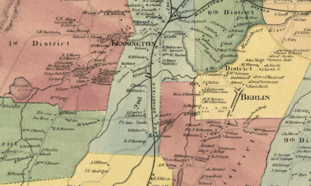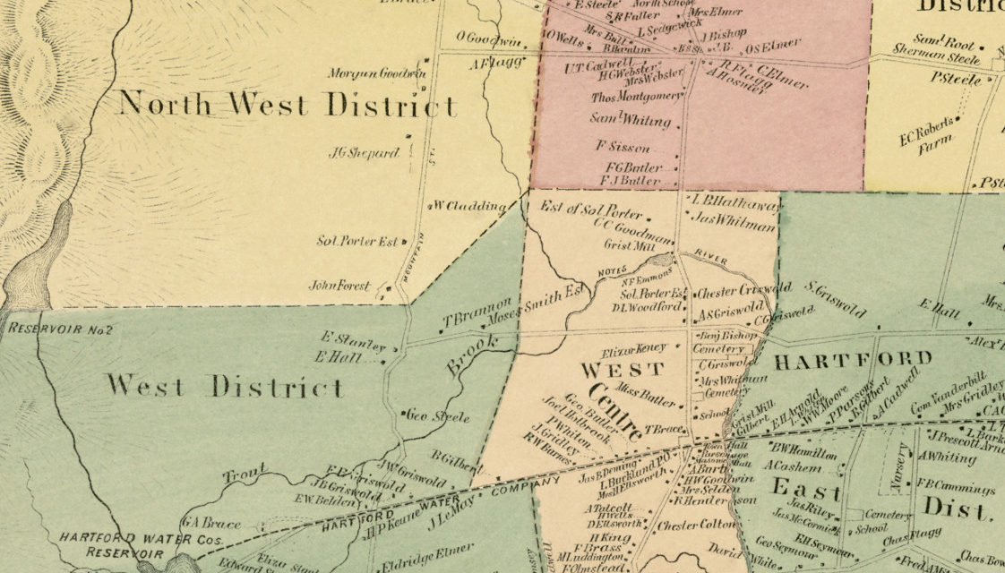
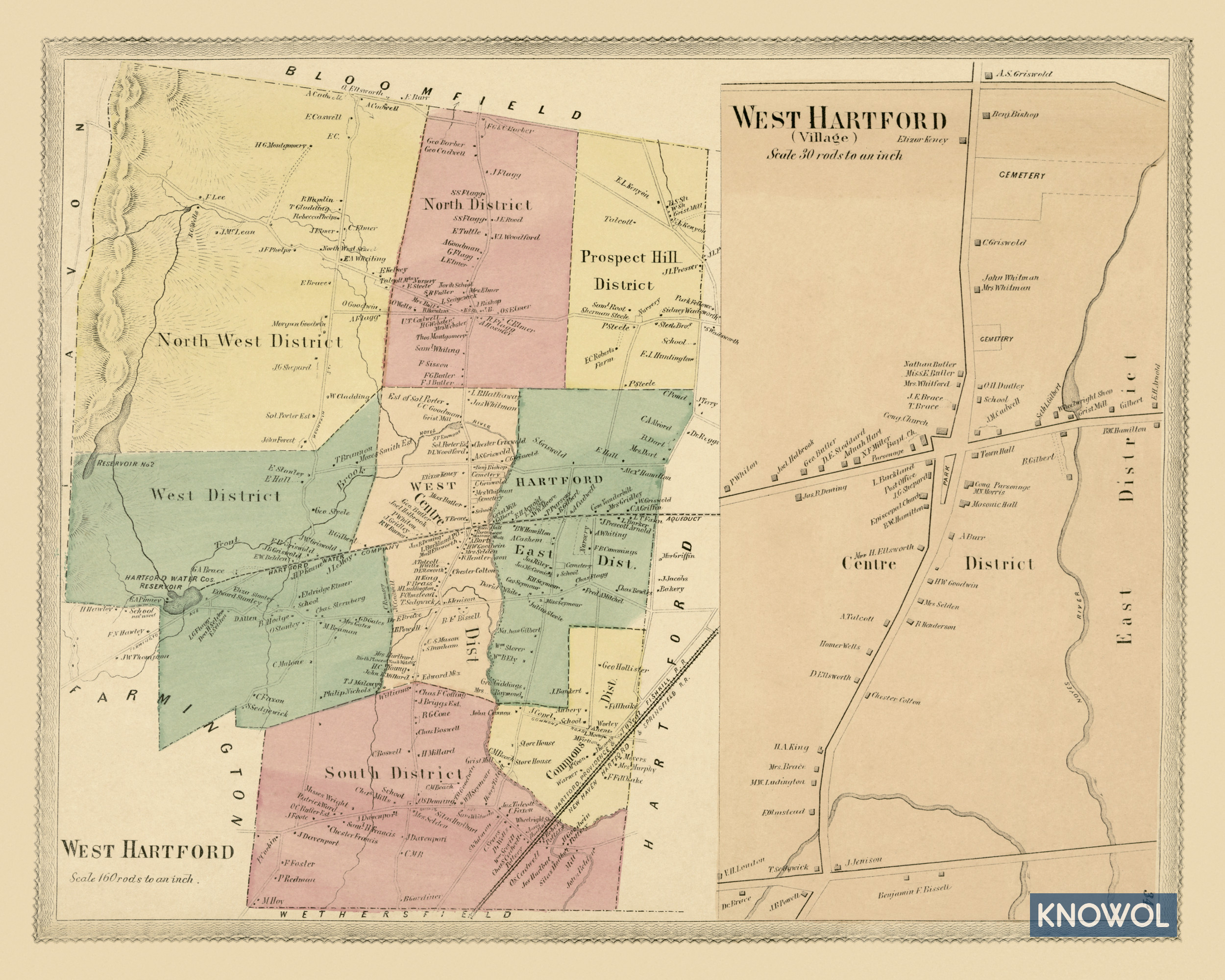
This historic landowners map of West Hartford, Connecticut was created in 1869 by Baker & Tilden, publishers from Hartford. The map features nine districts: North West, North, Prospect Hill, Hartford East, South, Commons, Centre, Joint, and West Centre District.
Each plot of land is labeled with the name of the person who owned the land at that time. Landmarks on the map include the Hartford Water Reservoir, Farmington Ave, Hartford, Providence & New Haven Railroad, Town Hall, Masonic Hall, an aqueduct, unused school, Episcopal Church, Congregational Church, and more.
This historic map of West Hartford was restored by KNOWOL. Reproductions of the map are available here.
Landowners Map of West Hartford, CT from 1869
This vintage map of West Hartford makes an attractive addition to your office, library, or den and can even be used to teach children the geography and history of the area. When you’re done exploring, click here to get your copy.