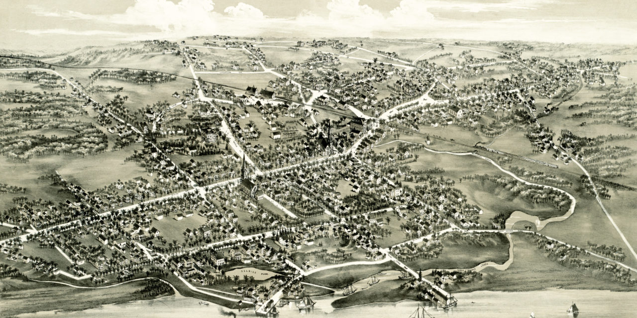
This map of Stratford, Connecticut was created in 1882 by O.H. Bailey. Bailey spent weeks analyzing town records to create an outline of the streets and then walked through town sketching buildings, landmarks, and other features.
The map features a detailed bird’s eye view of Stratford, CT in 1882. The bottom of the map also includes a drawing of the original planned layout of Stratford from 1824.
KNOWOL restored the map to ensure Stratford’s history can be shared with future generations. Reproductions of the map are available through our store and a free high resolution image can be viewed below.
Bird’s Eye View of Stratford, Connecticut in 1882
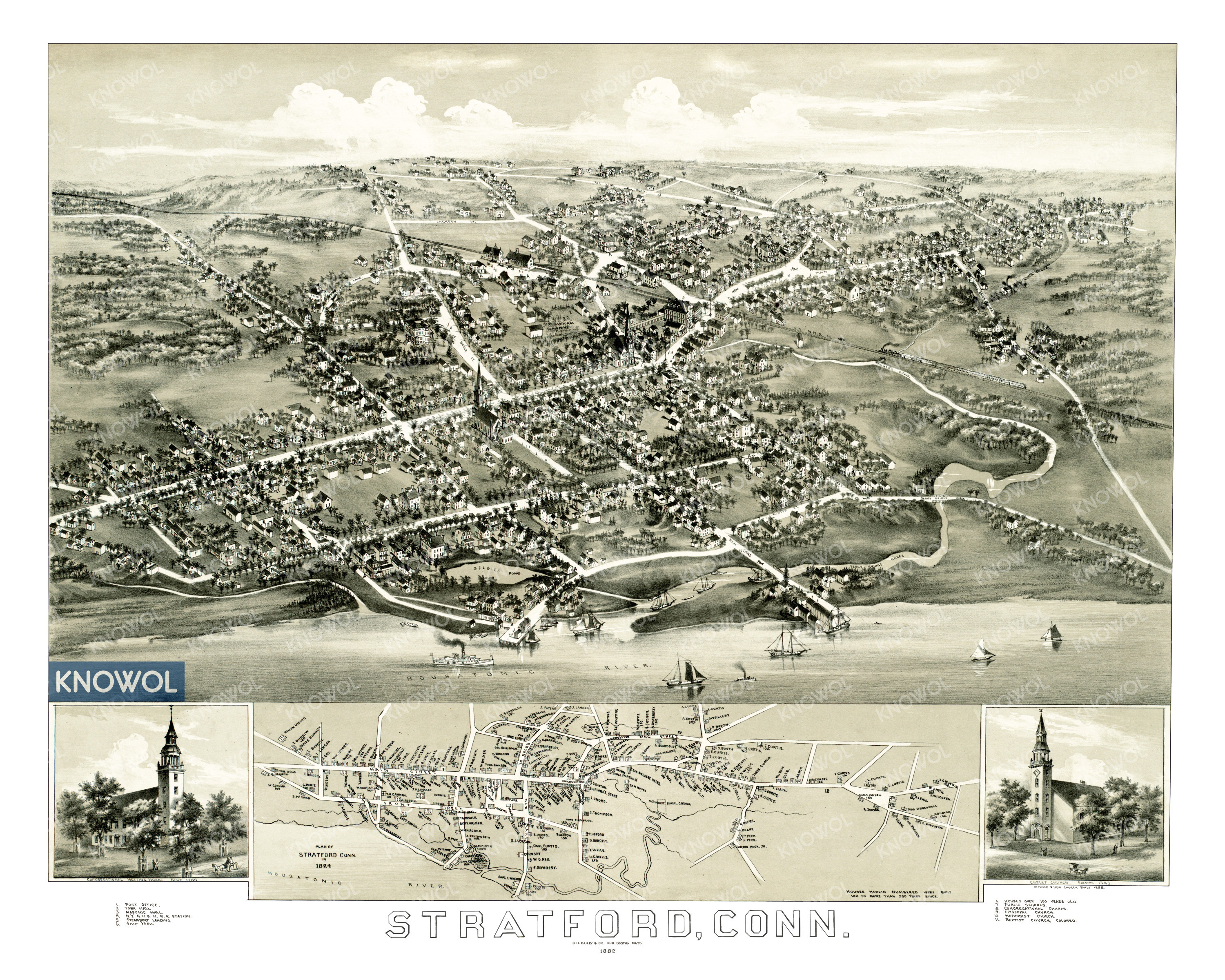
Old Stratford landmarks on the map include the Masonic Hall, Steamboat Landing, Congregational Meeting House, Stratford Shipyard, Selby Pond, and a number of houses that were built in the 18th century.
Reproductions of this historic map of Stratford are available on museum quality, archival paper to ensure that this piece of local history can be passed to the next generation. Click here to get a copy of the restored map from our store!