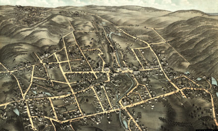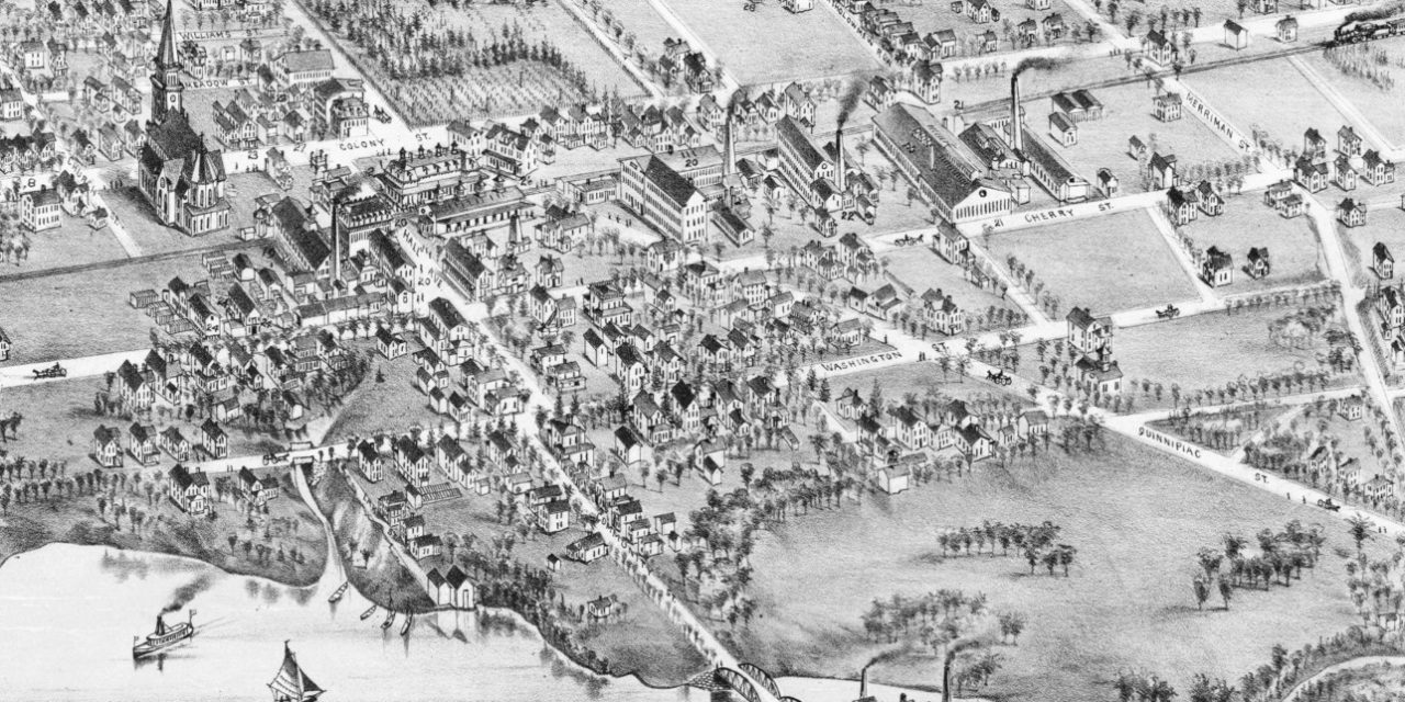
This historic map of Wallingford, Connecticut was created in 1881 by O.H. Bailey, a prominent 19th century map maker. The map shows a bird’s eye view of Wallingford as it used to be, including street names and old landmarks.
Landmarks on the map include the New York, New Haven, & Hartford Railroad Station, Franklin Hall, Doolittle Picture Frames & Printing, Oneida Community Limited, Wallingford Wheel Company, Curran’s Cigar & Sample Room, Leonard Blacksmithing, Ingraham House, churches, and more.
This historic map of Wallingford was restored by KNOWOL. Reproductions of the restored map are available here.
Bird’s Eye View of Wallingford, Connecticut in 1881
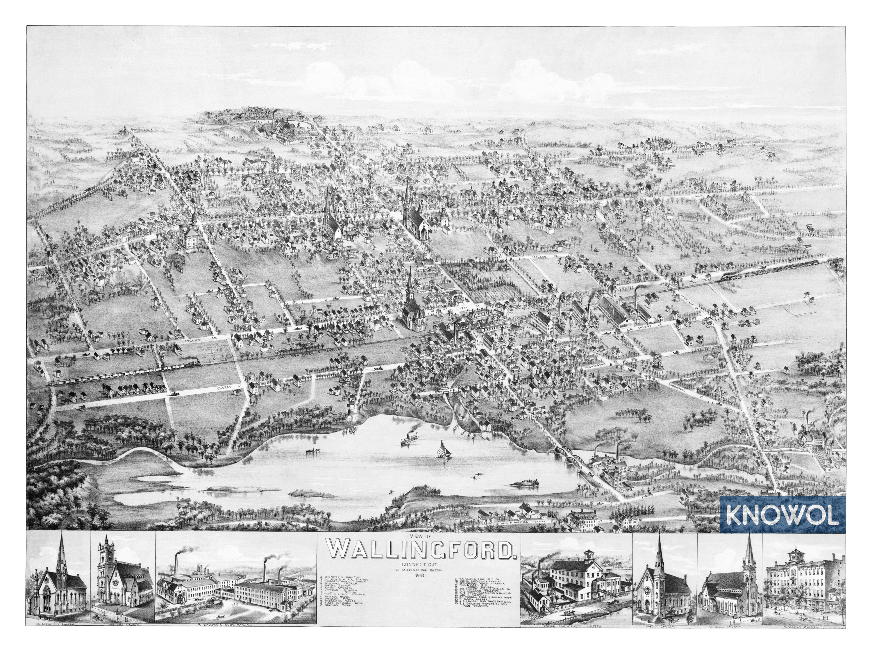
This old map of Wallingford makes an attractive addition to your office, library, or den and can even be used to teach children the geography and history of the area. When you’re done exploring, click here to get your copy.