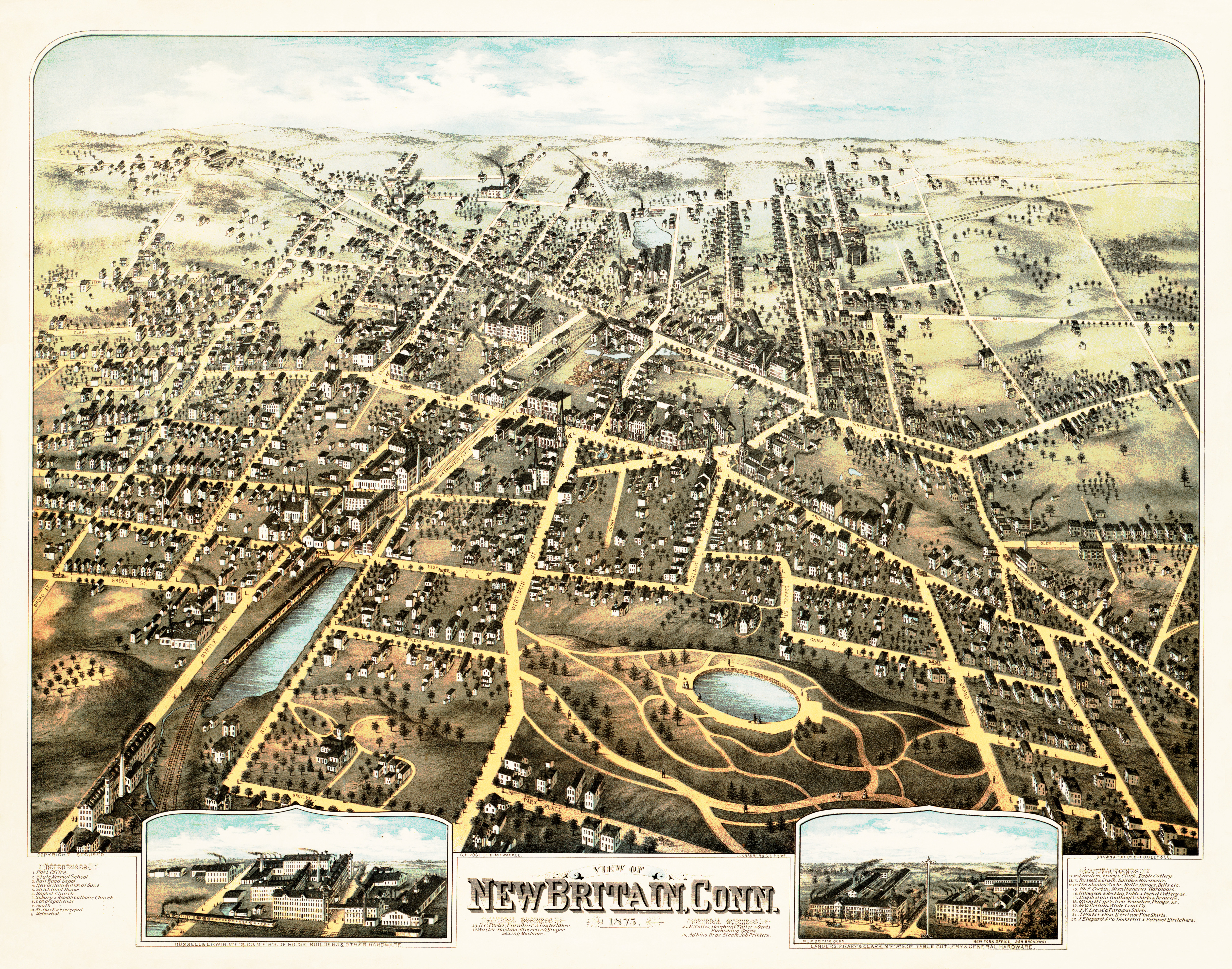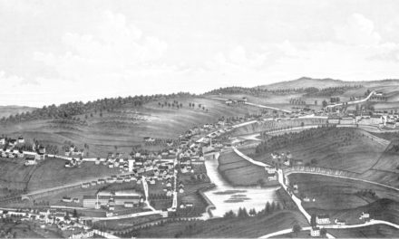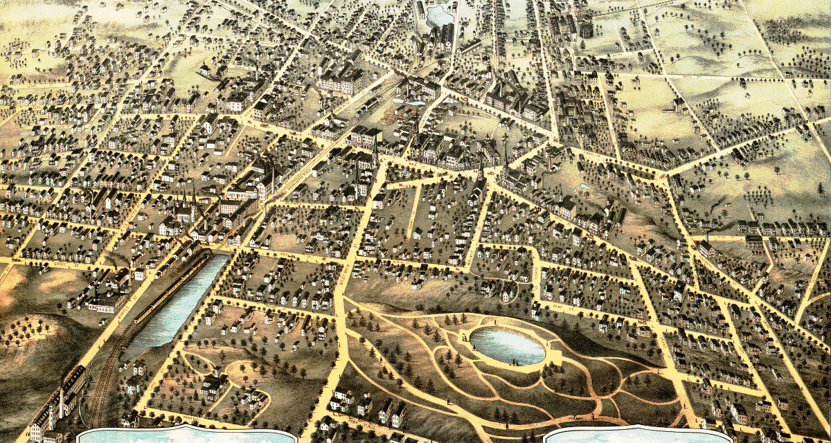
This map from 1875 shows New Britain, Connecticut and the surrounding area. The map was created by O.H. Bailey & Co., printed by J. Knauber and Co., and restored by KNOWOL. High quality reproductions are available here.
The map includes New Britain landmarks such as New Britain National Bank, the New Britain Railroad Depot, Strickland House, the Stanley Works, Adkins Brothers Printers and more.
Click here to see a high resolution scan of the map.