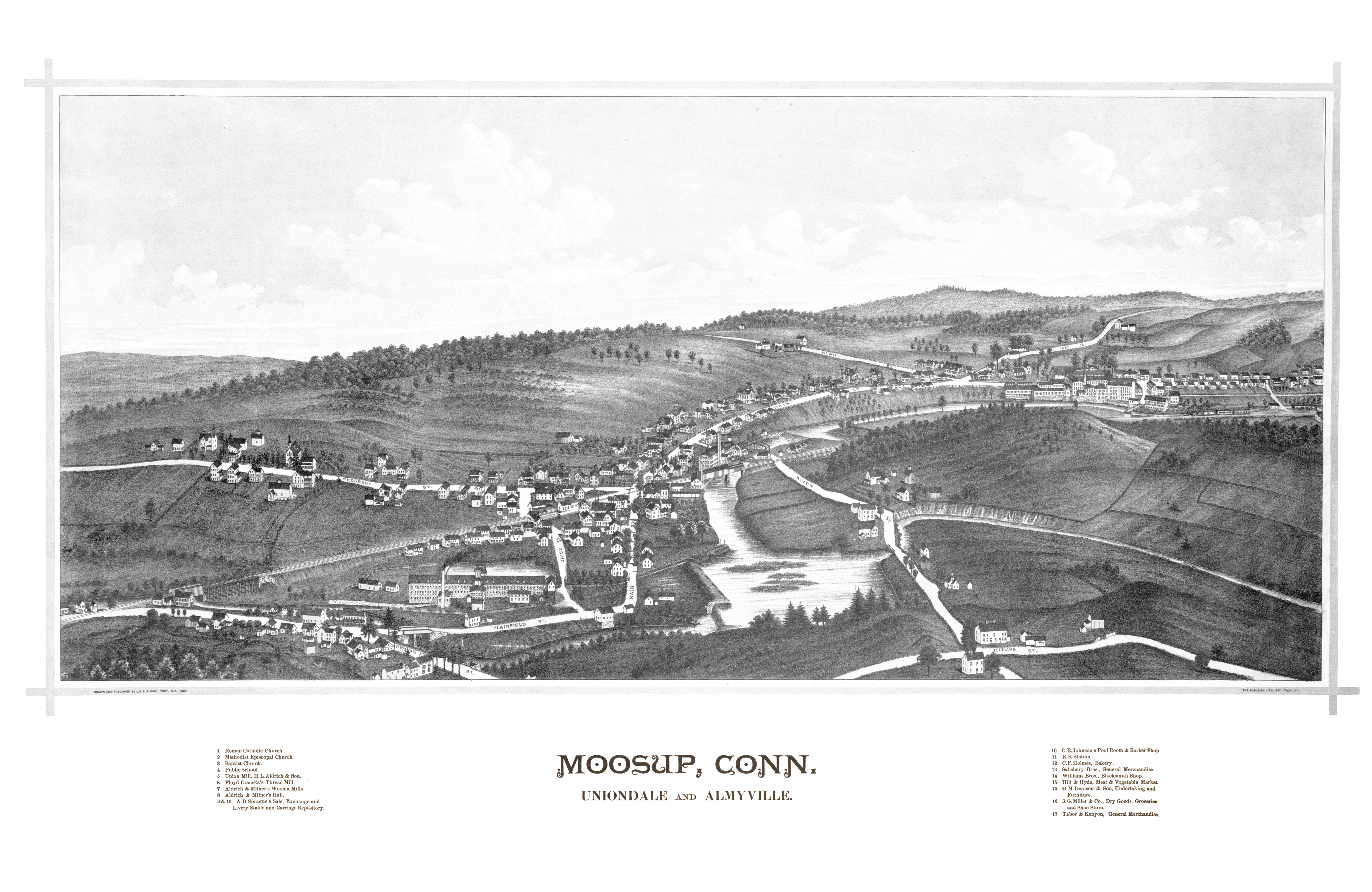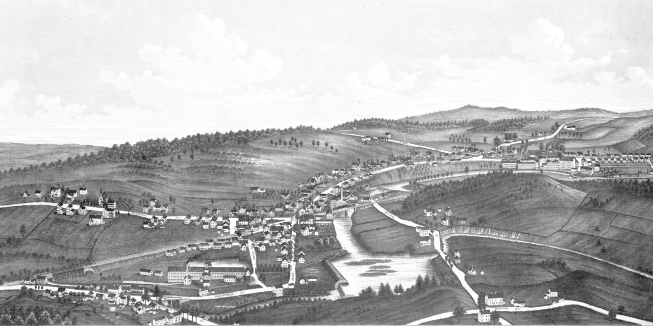
This map shows Moosup, Connecticut as it looked in 1889. The map was originally created by Lucien R. Bureleigh, and has been restored to its original condition by KNOWOL.
The map includes Moosup landmarks such as Union Mill, Aldrich & Milner’s Woolen Mills, Moosup Railroad, Hill & Hyde market, C.R. Johnson’s pool room/barber shop and more.
Explore a larger copy of the map below, and then click here to get a high resolution print to display in your home.
Click here to see a larger version of the map.