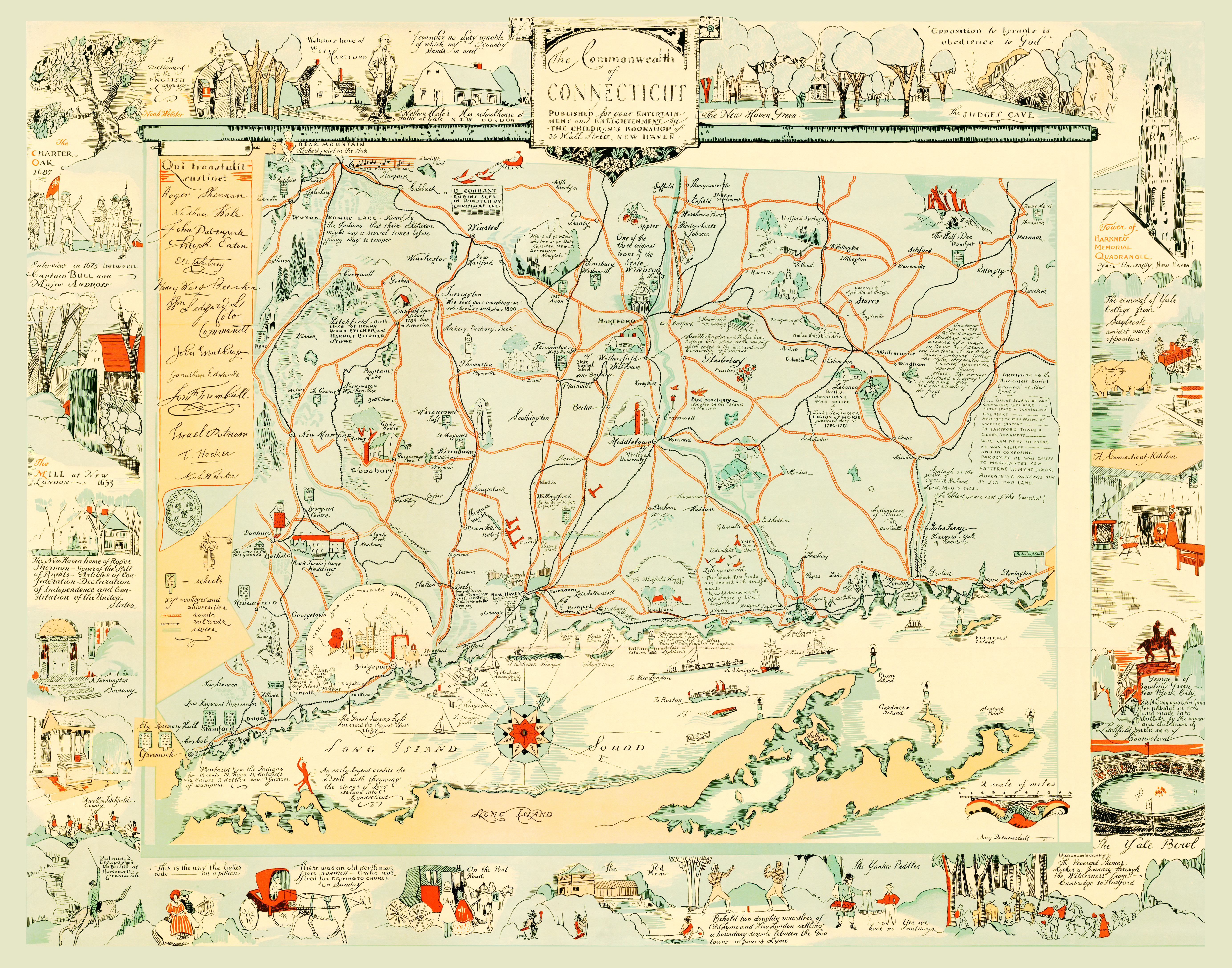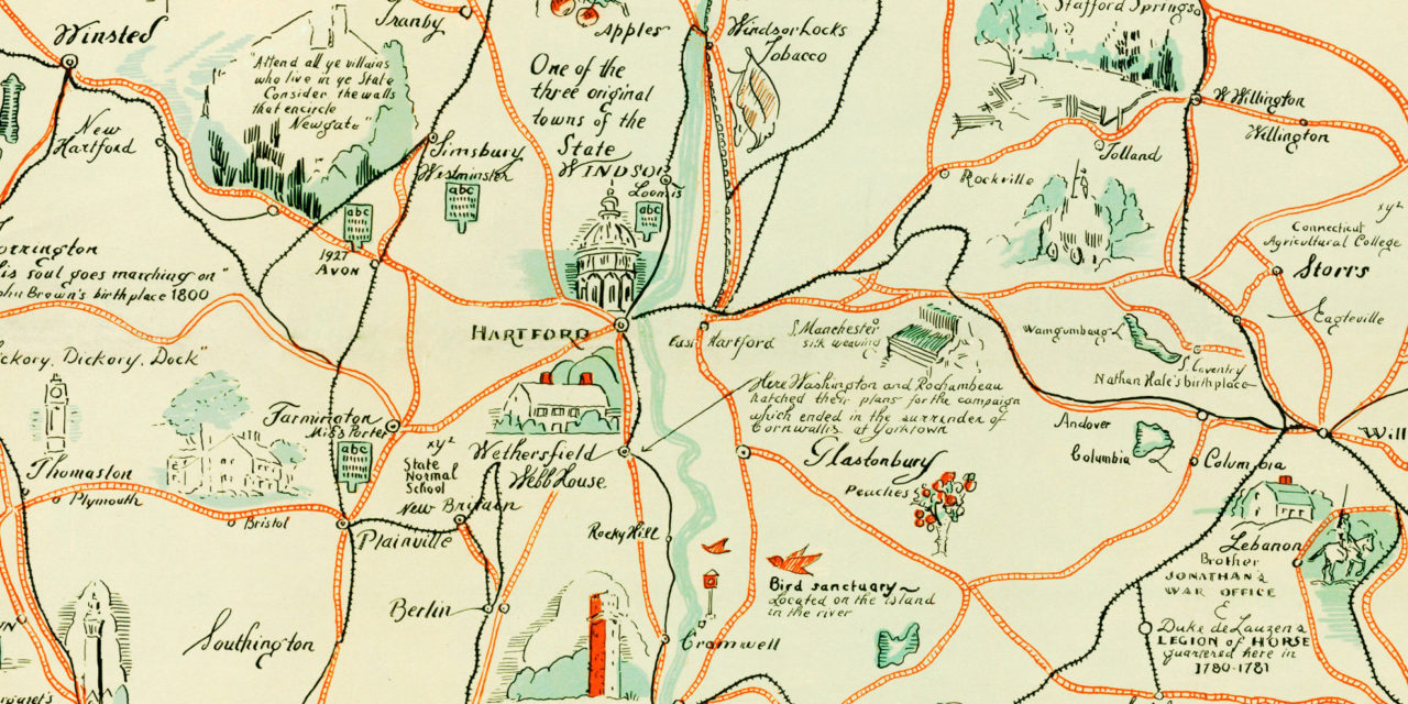
This beautifully illustrated map of Connecticut was created in 1921 for a children’s bookstore in New Haven, Connecticut. The map was illustrated by Amy Drevenstedt, who also illustrated The Bridge of San Luis Rey, a Pulitzer Prize winning book in 1928.
When we received the map it was torn and stained, so we digitally restored it to its original beauty. You can explore a larger copy of the map below, or click here to get a high resolution print.
Click here to see a larger version of the map.