
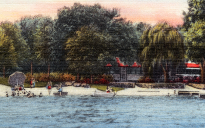
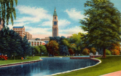
Gerald Park Beach on Lake Wangumbaug Coventry, CT
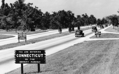
Historic Beauty of Connecticut’s Merritt Parkway Bridges
The Merritt Parkway was the first divided-lane, limited-access highway in Connecticut.
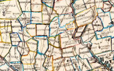
Vintage hand-colored map of Connecticut from 1857
This beautiful hand drawn map of Connecticut was created in 1857 by Laura Roys, a student who attended Hartford Female Seminary, an all-female academy in Hartford, Connecticut. The map is beautifully colored, with shades of blue, orange, red, pink, yellow, and violet adorning the border of each city and town.
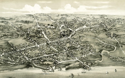
Beautifully detailed map of Wallingford, CT from 1905
Wallingford, Connecticut in the 19th century.
Historic map of Stratford, Connecticut from 1882
Historic bird’s eye view of Stratford, Connecticut from 1882
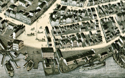
Beautifully restored map of New London, CT from 1876
Bird’s eye view of New London, Connecticut in 1876
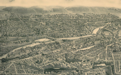
Beautifully restored map of Ansonia, Connecticut from 1921
Old map showing an aerial view of Ansonia, Connecticut from 1921
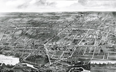
10 amazing old pictures reveal forgotten history of Hartford, CT
Hartford is the capital of Connecticut and one of the oldest cities in the United States. It is home to the nation's oldest public art museum (Wadsworth Atheneum), the oldest public park (Bushnell Park), the oldest continuously published newspaper (The Hartford...
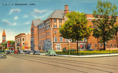
Vintage postcard of the YMCA in Bridgeport, CT from the 1950’s
Bridgeport's Young Men's Christian Association was formed in June, 1883, and the association was incorporated one year later. In October, 1888, Dr. I. de Ver. Warner, the president of the association, gave to the society the lot on the northwest corner of Main and...
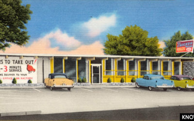
Vintage Picture of the Chicken Roost in Bridgeport from the 1950’s
The Chicken Roost was a restaurant in Bridgeport, CT that was famous for its “As You Like It” southern fried chicken.
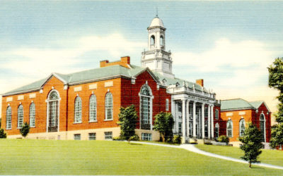
12 vintage postcards of UConn from the 1950’s
The University of Connecticut began its history in 1880, when two brothers…
9 beautiful old pictures of Berlin Turnpike landmarks
The Berlin Turnpike is a roadway in Connecticut that served as the primary route connecting Hartford and New Haven during the 1940's - 1960's. The Berlin Turnpike began as the Hartford and New Haven Turnpike, a toll road opened in 1799 that connected the courthouses...