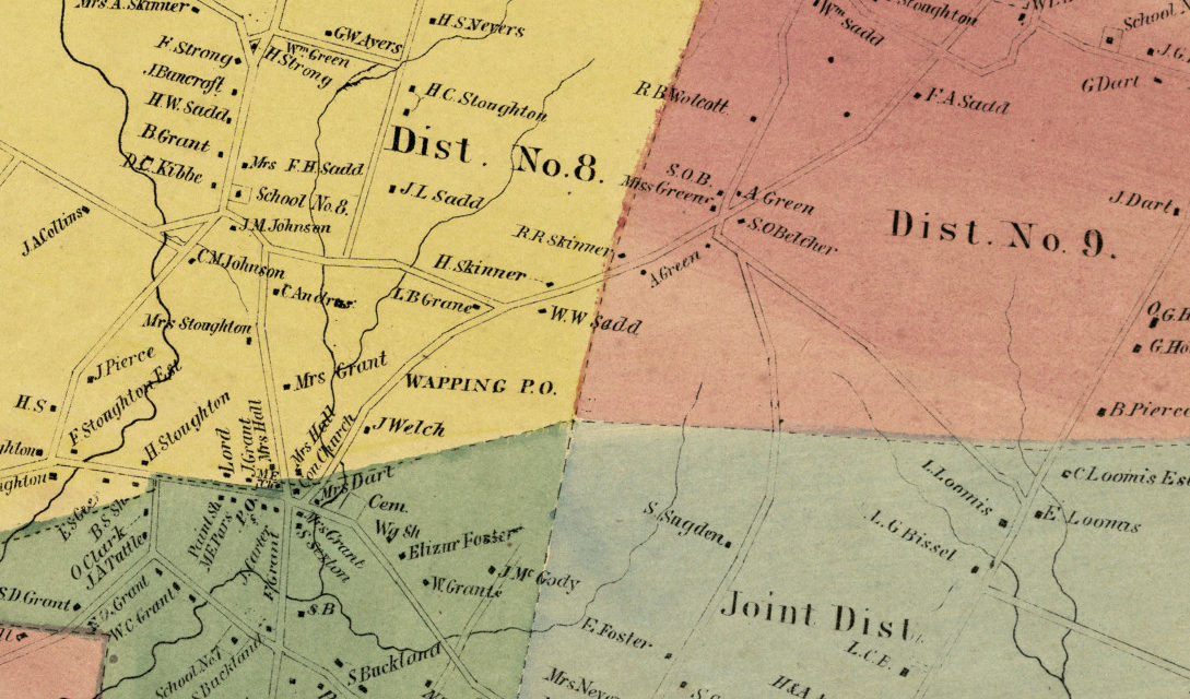
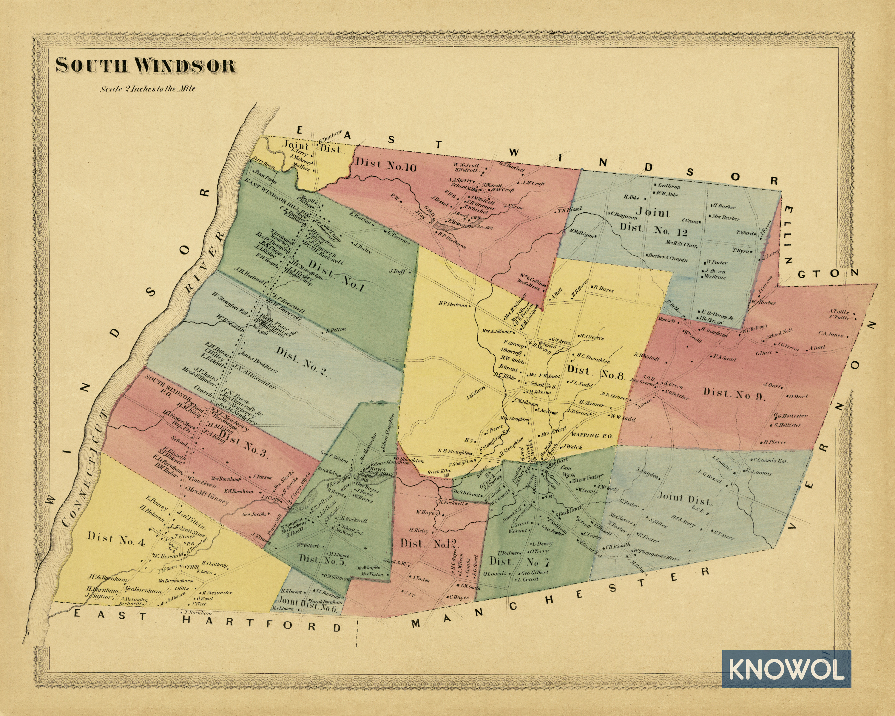
This historic landowners map of South Windsor, Connecticut was created in 1869 by Baker & Tilden, publishers from Hartford. The map features 14 districts, including joint districts with East Windsor, East Hartford, Ellington, Vernon, and Manchester.
Each plot of land is labeled with the name of the person who owned the land at that time. Landmarks on the map include the South Windsor Town Farm, East Windsor Hill Post Office, J.H. Chartton School, Theological Seminary, Risley’s Wagon Shop, D.J Foster’s Store, Wapping Post Office, Brick Kiln, the home of S. Buckland, and more.
This historic map of South Windsor was restored by KNOWOL. Reproductions of the map are available here.
Landowners Map of South Windsor, CT from 1869
This vintage map of South Windsor, CT makes an attractive addition to your office, library, or den and can even be used to teach children the geography and history of the area. When you’re done exploring, click here to get your copy.