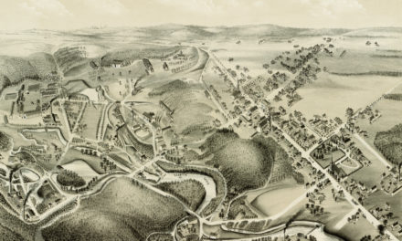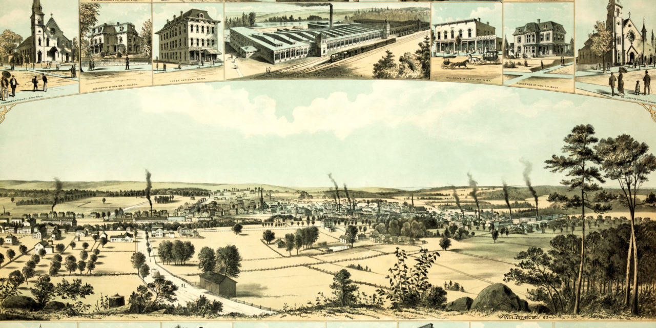
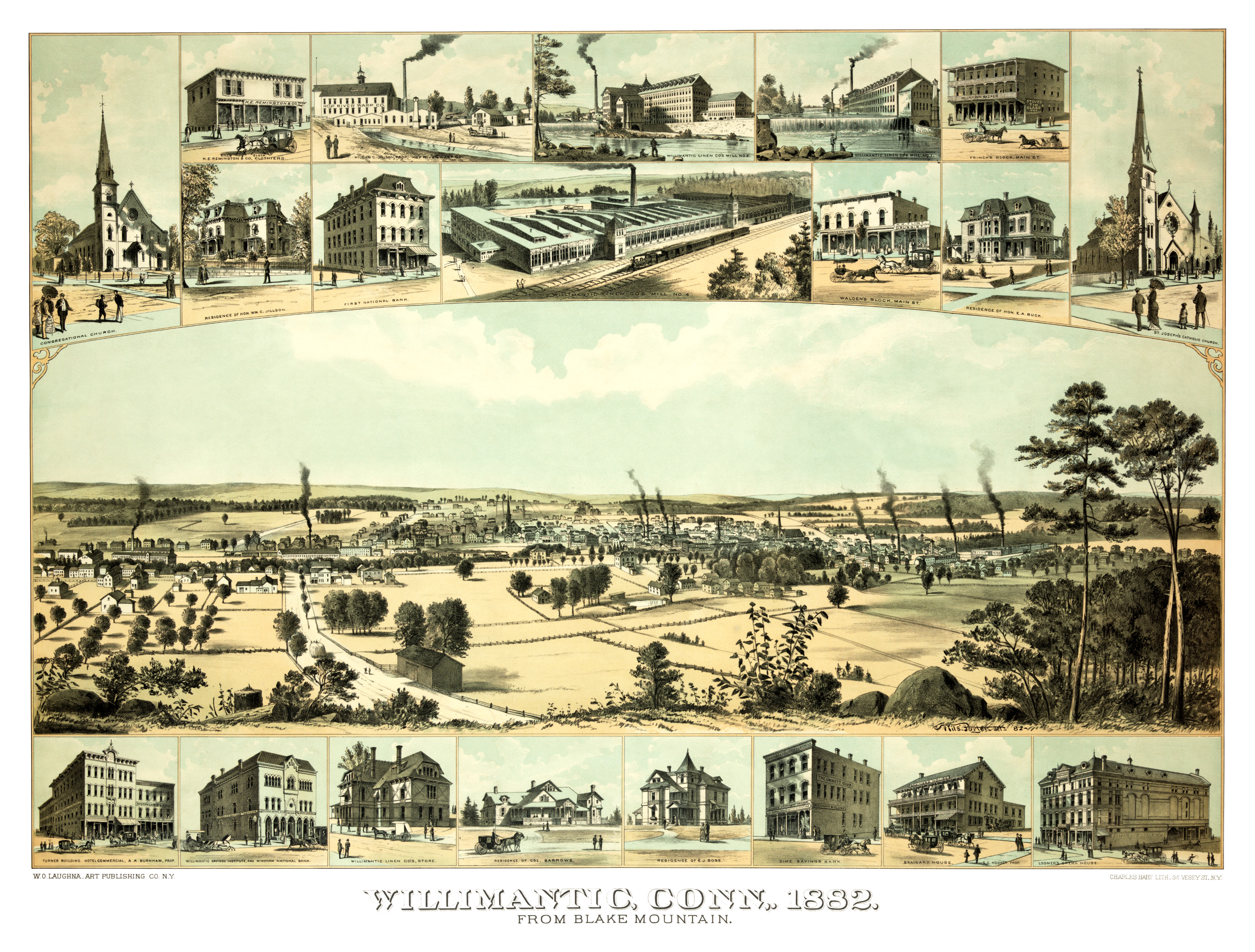
This old map of Willimantic, Connecticut was created in 1882 by Nils Porter, and the Charles Hart Lithography Company. At the time Willimantic was still a borough of Windham. It became a separate city in 1893.
From the 1860’s until the 1940’s, Willimantic was a major center of production for silk and cotton thread, earning it the nickname “Thread City”. Irish, Italian, Polish, German and French Canadian immigrants moved to the town in droves in search of mill work. Estonian, Ukrainian, Latvian, Lithuanian and Puerto Rican immigrants soon joined.
In the early 20th century, between 50 and 100 trains ran through Willimantic each day, fostering the town’s growth from a population of less than 5,000 in 1860 to 12,100 by 1910, more than doubling the population in 40 years.
The map shows a bird’s eye view of Willimantic as it looked during its most prosperous years, including landmarks such as the Willimantic Linen Company, Loomer’s Opera House, Windham National Bank, Willimantic Savings Institute, the Turner Hotel, Brainard House and more.
Click here to see Willimantic, CT in 1882.
This old map of Willimantic has been lovingly restored by the team at KNOWOL. Reproductions of the restored map are available on museum quality, archival paper to ensure that this piece of Willimantic history can be passed on to the next generation. Click here to get a copy of the map.