
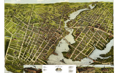
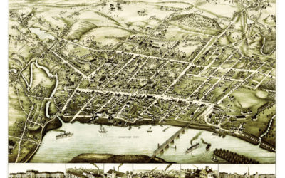
Amazing bird’s eye view of Bridgeport, Connecticut in 1875
This is how Bridgeport looked when only 20,000 people lived there!
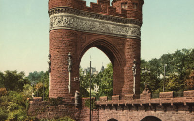
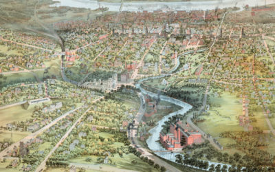
Hartford’s State Capital, Memorial Arch, and Bushnell Park
These pictures of Hartford, Connecticut were taken over the span of 20 years, from 1900 -1920.
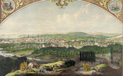
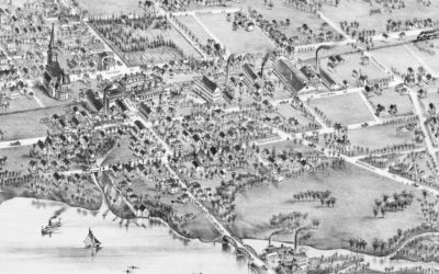
Cityscape view of Bridgeport, Connecticut from a nearby hill in 1857
This beautiful vintage print shows Bridgeport, Connecticut as it looked in 1857. The artist, Walter Staengel, sat atop what was then known as "Old Mill Hill" and drew this print by hand. He signed the print, "Drawn from nature and on stone by W. Staengel, 66 Cannon...
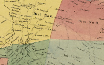
Historic landowners map of South Windsor, CT from 1869
Vintage landowners map shows South Windsor, Connecticut as it used to be
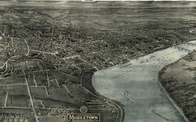
Bird’s eye view of Middletown, Connecticut in 1877
This beautiful vintage map shows Middletown, Connecticut as it looked in 1877. At the time approximately 7,000 people lived in Middletown and manufacturing was the mainstay of the city's economy. The map highlights Middletown landmarks such as Wesleyan University,...
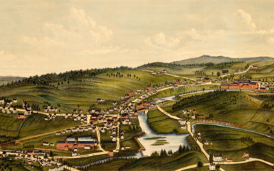
Beautifully restored map of Wallingford, Connecticut in 1881
Historic bird’s eye view of Wallingford, Connecticut
Beautifully detailed map of Westport, CT from 1878
Detailed bird’s eye view of Westport, Connecticut in 1878
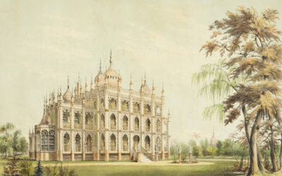
Iranistan, P.T. Barnum’s lost palace once located in Bridgeport, CT
P.T. Barnum, most famously known for founding the Barnum & Bailey Circus…
Beautifully detailed map of Stamford, CT from 1875
Historic bird’s eye view of Stamford, Connecticut in 1875
Beautifully detailed map of Hartford, Connecticut from 1864
Historic bird’s eye view of Hartford, Connecticut from 1836
Vintage map shows Middletown, Connecticut in 1915
This old map shows Middletown, Connectiicut in the early 20th century.
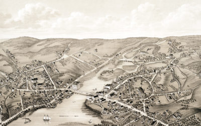
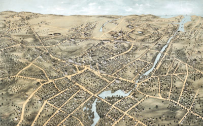
Old map showing a bird’s eye view of Moosup, Connecticut in 1889
This old map shows Moosup, Connecticut in the late 19th century.